5
December, Ban Po to Sapa, 44km
Sapa Backpackers Hostel 240,000VND
There was
such a “white-out” when we arrived in the mountainside town of Sapa that standing
just 20 metres from our reserved hostel we could neither see nor find it.
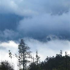
Two-thirds of the distance cycled today was uphill; in other words we had 30km
of climbing, long, intermittent sections of it at 10%. The first 5km incline took
us from Ban Po to a T-junction: west to Lai Chau; east to Sapa. The road to
Sapa crosses the Tram Ton Pass on the northern side of Fansipan, at 3,143m the
highest mountain in Indochina. The pass, Vietnam’s highest at 1,900m, is said
to be incredibly beautiful. We can neither confirm nor deny this as we saw
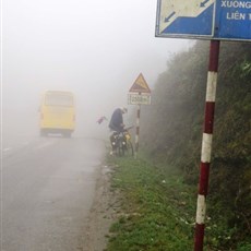
nothing at all of the surrounding scenery on our long slow ascent. It was misty
and damp, reducing visibility at times to less than 10m. I managed to cycle all
but 1.8km of the climb to the top of the pass, where it was windy and icy cold.
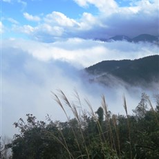
Within minutes of beginning our 15km drop into Sapa, the coldest town in Vietnam,
we were treated to moments of blue-sky clarity; treated to fabulous views of
mountain tops above clouds trapped in valleys. It was a stunning ride, and exhilarating,
but as we cycled, we became increasingly aware of just how quickly the weather
can change here in the winter months. We would stop to photograph an appealing
scene, get out our cameras and look up to find what we had planned to
photograph was now hidden beneath fast-moving cloud. By the time we reached
town, we were back in a white, white world.
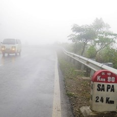
Between Ban Po and Sapa - climbing the pass
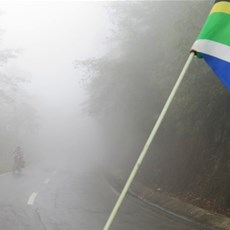
Between Ban Po and Sapa - climbing the pass
Between Ban Po and Sapa - at the top of the pass
Between Ban Po and Sapa
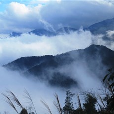
Between Ban Po and Sapa
Between Ban Po and Sapa
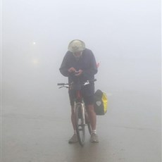
Sapa - trying to find our hotel