2000 Biking New Zealand
Day 11, 18 December 2000, Monday
Punakaiki – Murchison; 140km @ 15kph, Kiwi Park,
$40
Today we spent 14 hours getting from
Punakaiki to Murchison. We arrived here shattered and knee-sore at 9.30pm –
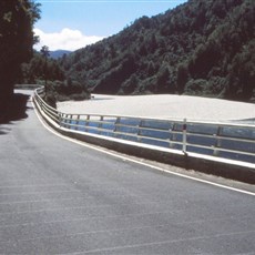
grateful for the wide shoulder we encountered on the last 12km into town which
provided additional protection in the rapidly-waning light (in addition to our
WideBerth devices, flashing lights, neon bibs and chevron strips on helmets).
We booked into our accommodation and as we were too tired to cycle the 800m
back to town to a pub for dinner, we sat on our beds and devoured the snacks we
had been carrying with us – cookies, biscuits, sweets and cheese. Washed down
with a cognac nip and left-over orange juice.
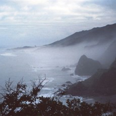
The road from Punakaiki to the turnoff just
south of Westport
is hell on wheels – especially with tired legs. But really beautiful on a
cloudy cool misty morning. Headlands dropping one after the other into the Tasman Sea. Mist-enshrouded and clothed in green.
Driftwood-strewn beaches and bays with limestone outcroppings in a gentle sea.
Cottages tucked away both sides of the road – secluded and at ease. A giant
stone arch on the right hand side of the road, quickly glimpsed and enjoyed on
a downhill run. Rhododendrons growing wild. And scrubby tea bush covering the
hillsides, decked in a pretty tiny white flower. It really is stunning here.
Again, we would have liked to spend more time. On one section of the road there
was a sign saying ‘Caution 10km’ with a picture of a penguin thereon. Didn’t
see any penguins, unfortunately.
We averaged a slow 13 to Charleston – in fact it took us 2.5 hours to
do the first 25km. We breakfasted there at the Motor Park
tearooms – where the young woman serving us also acted as the postman. She was
charmingly attired in a Dad Xmas hat and little father Xmas earrings. There was
a fascinating historical map of Charleston
on the wall. Hand drawn in black and white. Showing the town as it once was
obviously at the height of the gold era. Each house labelled with the owner’s
name, all hotels shown, the alluvial diggings, court house, watchmaker,
butcher, etc. Also some famous people like the licensed bar keeper (a woman)
and others.
It was still tiring but less so after Charleston. With a heat
behind the cloud cover just waiting to pounce. When we finally reached the
turnoff to Nelson 6km before Westport – after passing the turnoff to the
appropriately named I assume Cape Foulwind – we chatted there to a hitchhiking
Hollander who had been waiting for a ride for over an hour, sharing some sweets
with him. He passed us soon after we had left him – Nelson-bound. And
undoubtedly reached his destination long before we reached ours.
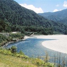
By the time we entered the Buller River
Gorge, the sun was hot on our backs; and it grew hotter and hotter as the
afternoon progressed. Buller is a valley more than a gorge; wide enough for the
wide Buller River – clear and cool looking and
deceptively gentle – a road on one side and a now-and-then-visible railway on
t’other. With thickly-clad green hills on either side and the hot blue sky
above. Really beautiful.
We took a break at the Berlins Hotel part
way up the gorge. Berlins,
named after its Swedish proprietor, has been here since about 1874. Its history
is told in photos on the pub wall. We were particularly interested in the flood
that occurred on October 3 in 1988 during which the river rose by 11.4m to
flood Hawkes Crag past which we had just cycled. At the Crag the road narrows
to a single lane and the rock is carved out just enough to accommodate a bus.
Our last stop before Murchison – with
Murchison still a daunting 51km away – was in minuscule Inangahua. The
garage-cum-shop here had a fence made of old bicycles and the owner, who was
watering his plants, was bemused when I borrowed his hose and wet my head
through my helmet. It really was ridiculously hot by this time. We stocked up
on drinks and called and left a message at the Kiwi Park
to say we would be late – it was already 5pm.
The rest of the route, though lovely, was
almost unbearable. Really too far for our level of fitness and our accumulating
exhaustion. And hot, hot, hot. At one point Charl actually removed his T-shirt
and dunked it in water running off the mountain on our left. And we both used
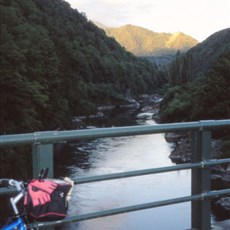
up quite a lot of drinking water for cooling our heads. There is a suspension
bridge about 15-20km outside Murchison. A father and son, towing a trailer
behind their car, were exploring this when I passed by (they had passed me a
little earlier). Sometime later, passing Charl cycling quite far behind me,
they offered him (and me) a ride. He declined – brave boy! On our route today
were a couple of geological markers – apparently the Alps
continue to rise by several cm each year.
When we finally reached Murchison it was
already dark. When we rang the bell at the Kiwi Park
desk to summon our host, we were met and booked in by a man in a green cap
which read : if you outlaw guns only outlaws have guns. I said I agreed with
the sentiment and started to mention South Africa’s new gun legislation.
But he knew all about it and interrupted me to say ‘they’ were bringing in very
strict rules in South Africa but the ‘crazy black’ who in any case did not obey
the law, would continue to own illegal guns!
There is a photograph on the wall of the
kitchen here showing an earthquake splat-flattened school and unintentionally
appropriately labelled ‘Flatfern school on fault line’ – being the fault line
between the Australian and Pacific plates which runs north/south through much
of New Zealand.

En route Murchison

En route Murchison

Buller Gorge

Buller Gorge